Contents
What Is Data Labeling?
1. Encord – End-to-End Multimodal Platform
2. Sama – Scale, Quality & Multimodal Depth
3. iMerit – Geospatial & Public Sector Ready
4. Labelbox – Flexible & Multimodal with Strong Ecosystem Integration
5. Annotell – Safety / Perception Analytics Specialty
6. Snorkel Flow (Snorkel AI) – Programmatic Labeling & SME Collaboration
Choosing the Right Data Labeling Platform
Why Encord Still Leads (Even Among New Players)
Encord Blog
6 Best Data Labeling Platforms for Smart Cities AI [2025]
5 min read

Smart city AI depends on high-quality labeled data from video, LiDAR, sensors, and satellite imagery. In 2025, Encord is the best data labeling platform for smart cities — offering multimodal support, AI-powered automation, and enterprise-grade compliance for public sector and infrastructure projects.
AI is transforming smart cities, from real-time traffic management and environmental sensing to public safety, infrastructure monitoring, and citizen services. But even the most advanced urban AI systems depend on accurately labeled data.
High-quality labeled training data is essential in smart city deployments where stakes are high, and data is multimodal: video, satellite, aerial imagery, LiDAR, sensor data, etc.
In smart cities, AI relies on:
- Video from traffic cameras, CCTV, and public safety monitoring
- LiDAR, radar and 3D point clouds for mapping infrastructure, autonomous transit, obstacle detection
- IoT sensor and telemetry data from water, energy, air quality, sound, waste etc.
- GIS / geospatial / satellite/aerial imagery for planning, zoning, land use, flood risk
- Anomaly detection for utilities, environment, structural health, etc.
Choosing the right data labeling platform is critical. Here are the top 6 platforms for smart city AI in 2025, including some newer names.
What Is Data Labeling?
Data labeling is the process of tagging or annotating raw data, such as images, videos, LiDAR scans, text, or sensor readings, so that AI models can recognize patterns and make accurate predictions. In smart city applications, data labeling enables AI systems to understand complex urban environments by identifying objects (like vehicles or pedestrians), detecting anomalies, and correlating information across multiple data sources. High-quality labeled data is the foundation for building reliable, safe, and scalable AI-powered smart city solutions.
1. Encord – End-to-End Multimodal Platform
Encord remains strong for enterprise-scale, multimodal workflows. It supports video, LiDAR, sensors, images, etc., making it suitable for traffic flows, infrastructure monitoring, and public safety applications in the city.
Key features:
- Annotate video, LiDAR, 3D, images + text/audio. The platform is also video-native, making it ideal for computer vision applications
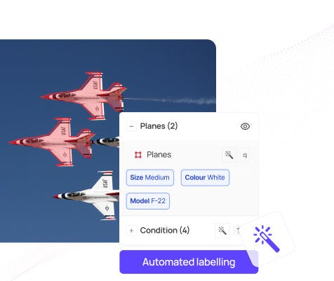
- Automation to help with repetitive frame interpolation, motion tracking and SAM 2 integration for faster labeling
- Workflow management: QA dashboards, role-based access, collaboration, monitoring for enhanced visibility and observability across enterprise-grade AI teams
- Strong compliance: GDPR, SOC2 etc., which is critical for public sector data
Best for: Municipal governments, integrators, smart city service providers needing a full data ops stack.

2. Sama – Scale, Quality & Multimodal Depth
Sama has expanded its features recently, adding better LiDAR / 3D support, plus enhanced tooling for annotating large scale, complex multimodal data.
Key features:
- Very high throughput that allows for hundreds of millions of frames or annotation shapes per month
- Strong quality assurance and human-in-the-loop processes for catching edge cases, sensor errors etc.
- Multimodal support (video, images, LiDAR), with capabilities to handle sensor fusion tasks
- Reporting / dashboards for monitoring quality and progress
Best for: Cities and agencies needing reliable, large-scale annotation for multimodal systems, especially safety-critical ones.
3. iMerit – Geospatial & Public Sector Ready
iMerit is a newer consolidated platform that brings together automation, annotation tools, and analytics. Strong credentials in geospatial work, public sector, and domains where data privacy and domain expertise matter.
Key features:
- Handles image, video, LiDAR, sensor fusion, and geospatial / remote sensing imagery.
- Workflow automation + analytics, with QA and reporting.
- Strong public sector / government credentials (secure offices, compliance) and experience.
- Domain specialists / subject matter experts in geospatial imagery and mapping.
Best for: Urban planning agencies, mapping departments, municipalities needing precision in GIS / aerial imagery, and secure public data handling.

4. Labelbox – Flexible & Multimodal with Strong Ecosystem Integration
Labelbox has matured a lot, and is widely used across industries including those relevant to smart city applications. Its feature set supports many modalities and use cases.
Key features:
- Supports image, video, audio, geospatial tiled imagery, documents etc.
- Good tooling for segmentation, object detection, classification; well‐designed annotation interfaces and integrations.
- Strong for teams that want a mix of managed service + self-serve tooling.
Good presence / support in Europe (useful for GDPR, local compliance).
Best for: Municipal AI/ML teams wanting a flexible platform that can adapt as their needs grow, especially where different data types are involved.
5. Annotell – Safety / Perception Analytics Specialty
Annotell is more specialized, but its strengths map well onto smart city perception problems (e.g. pedestrian detection, traffic, autonomous transit).
Key features:
- Strong video annotation, perception analytics; tools that help measure dataset quality and object detectability under different conditions.
- Keyframe interpolation, support for temporal coherence (useful for moving objects in traffic scenes etc.)
- Ability to connect sensor data to ground truth for safety/perception evaluation.
Best for: Smart mobility, autonomous transit, traffic analysis, intersections, any application where moving objects and detection under variable conditions matter.
6. Snorkel Flow (Snorkel AI) – Programmatic Labeling & SME Collaboration
For many smart city problems (e.g. anomaly detection, sensor fusion, monitoring), labeling can get expensive; programmatic or semi-automated labeling helps. Snorkel’s “Flow” product is strong here.
Key features:
- Labeling functions for automating parts of the labeling task (e.g. pattern matching, embeddings, keyword or feature-based rules) instead of doing everything manually.
- Tools for collaboration between domain experts / SMEs + data scientists. Good for ensuring labels capture domain nuance (e.g. what is “road obstruction”, “public safety breach”, “infrastructure damage”).
- Error / conflict detection & analysis; helps in iterating and improving label quality.
Best for: Budget-sensitive city projects, R&D / pilot projects, or where you have SMEs who can encode domain knowledge, but need to scale labeling more efficiently.
Choosing the Right Data Labeling Platform
| Use Case | Recommended Platform |
| Large scale multimodal infrastructure + transit + public safety | Sama or Encord |
| Geospatial / aerial / mapping + city planning + public sector requirements | iMerit |
| Traffic, moving objects, perception, safety thresholds | Annotell |
| Mixed data types, sensor + video + documents + audio | Labelbox |
| Pilot / R&D / budget limited but needing domain expertise | Snorkel Flow |
| Need full data ops + compliance + governance | Encord or iMerit |
Why Encord Still Leads (Even Among New Players)
While these new players bring compelling strengths, Encord continues to be a top contender in smart city AI because it provides:
- A truly multimodal stack: video, images, LiDAR, sensors, GIS etc.
- Strong tools for automation of repetitive tasks (frame interpolation, pre-labeling) + edge case detection.
- Workflow & dataset management with quality tracking, dashboards, role separation.
- Enterprise-grade governance and compliance capabilities (important for public sector, privacy, safety).
Explore our blog, if you want to explore the top data labeling platforms across different AI use cases.
Explore the platform
Data infrastructure for multimodal AI
Explore product
Explore our products
The best data labeling platform for smart city AI in 2025 is Encord, thanks to its end-to-end multimodal support, automation capabilities, and enterprise-grade compliance.
Encord enables teams to annotate video, LiDAR, images, 3D point clouds, and sensor data.
Its automation tools, including frame interpolation and integration with Segment Anything Model (SAM 2), significantly accelerate labeling speed while maintaining accuracy, making it the go-to choice for complex smart city datasetsEncord leads because it offers a true multimodal platform that handles the diversity of data smart cities produce, from CCTV video and LiDAR scans to IoT sensor data and GIS imagery.
Its workflow management, QA dashboards, and role-based access controls make it ideal for large municipal and enterprise teams managing critical urban data.
Additionally, Encord is fully GDPR and SOC 2 compliant, ensuring safe and ethical data handling for public sector applications.Unlike many platforms that specialize in only one modality (e.g., video or image), Encord unifies all data types, including video, LiDAR, text, images, and sensor data — into a single integrated environment.
It also features: advanced automation for repetitive labeling tasks, pre-labeling and AI-assisted annotation tools, comprehensive quality assurance and analytics, collaboration tools for large AI and data ops teams.Smart city AI involves data from multiple sources: traffic cameras, environmental sensors, LiDAR scans, and satellite imagery.
Encord’s platform allows teams to label, manage, and analyze all these modalities together, enabling better sensor fusion, anomaly detection, and AI model training.
Its native video and 3D support also ensures synchronized labeling across time and spatial dimensions, essential for real-time city analytics and infrastructure monitoring.Yes. Encord is designed for enterprise and public sector use, offering secure, compliant, and auditable data operations.
Its GDPR, SOC 2, and other compliance frameworks make it safe for handling sensitive or regulated data, such as public safety footage or environmental monitoring data.
Municipal governments, infrastructure agencies, and smart city integrators choose Encord for its security, scalability, and data governance features.While other platforms like Labelbox, iMerit, and Sama offer strong features for image or geospatial annotation, Encord’s differentiator is its end-to-end multimodal workflow and AI-assisted automation.
Encord uniquely combines:- Native support for video + LiDAR + sensor fusion
- Scalable enterprise workflows for large teams
- Comprehensive QA dashboards and dataset tracking
This makes Encord the most complete data labeling platform for complex, multimodal AI applications in smart cities.
Absolutely. Encord is built for enterprise-scale AI operations, capable of managing hundreds of thousands of assets and millions of annotations across teams.
Its workflow orchestration, progress tracking, and collaboration tools ensure large projects stay organized and on schedule, even when involving multiple data modalities or departments.


