
Build aerial AI that performs across every environment
Multi-sensor data collection, annotation, and curation for autonomous navigation, inspection, and monitoring systems - with managed data services to accelerate your pipeline.


Aerial AI faces a data diversity problem that compounds quickly
Tiny objects at long range, extreme weather variability, thermal-to-RGB alignment, and sparse edge cases in specific terrain types all require training data that's hard to collect at scale and harder to annotate precisely. Encord gives drone and aerial systems teams the infrastructure to manage multi-sensor data, annotate across spectral modalities, and systematically close the coverage gaps that cause models to fail in the field.
“The most valuable feature to us is the automated QA workflow that forces the ML engineers to be more incorporated into the labeling process.”

Conor Wallace
Machine Learning Engineer at Zeitview

The infrastructure aerial AI teams actually need
Multi-sensor annotation, geospatial-native tooling, and managed data services - all in one platform.
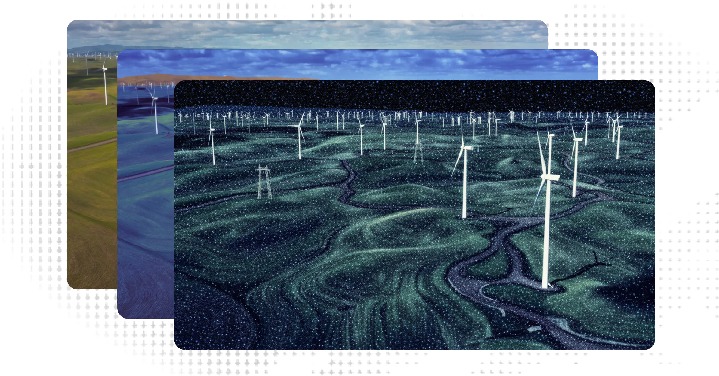
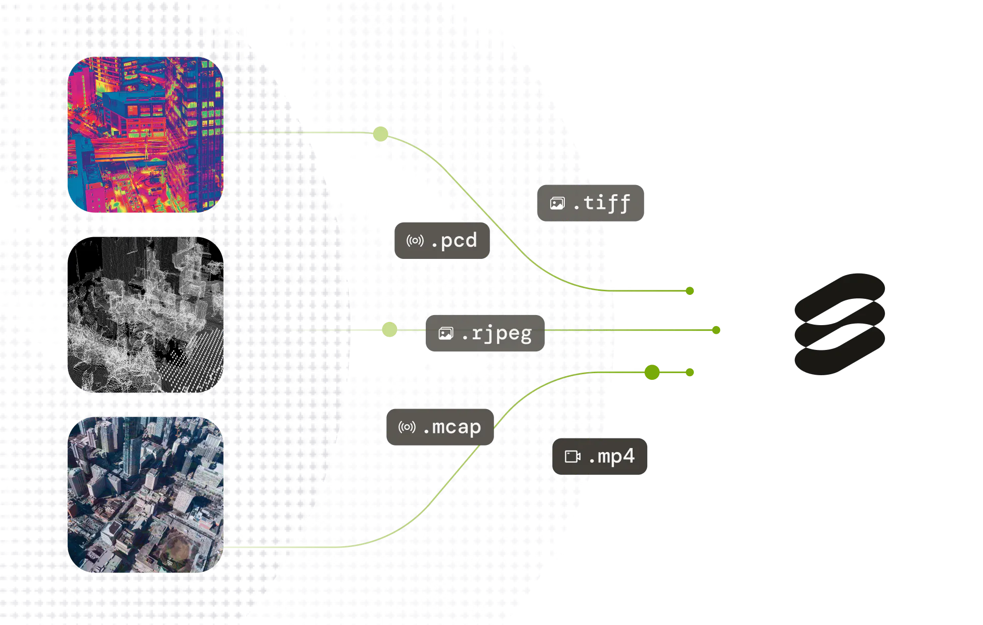
Multi-spectral annotation in one platform
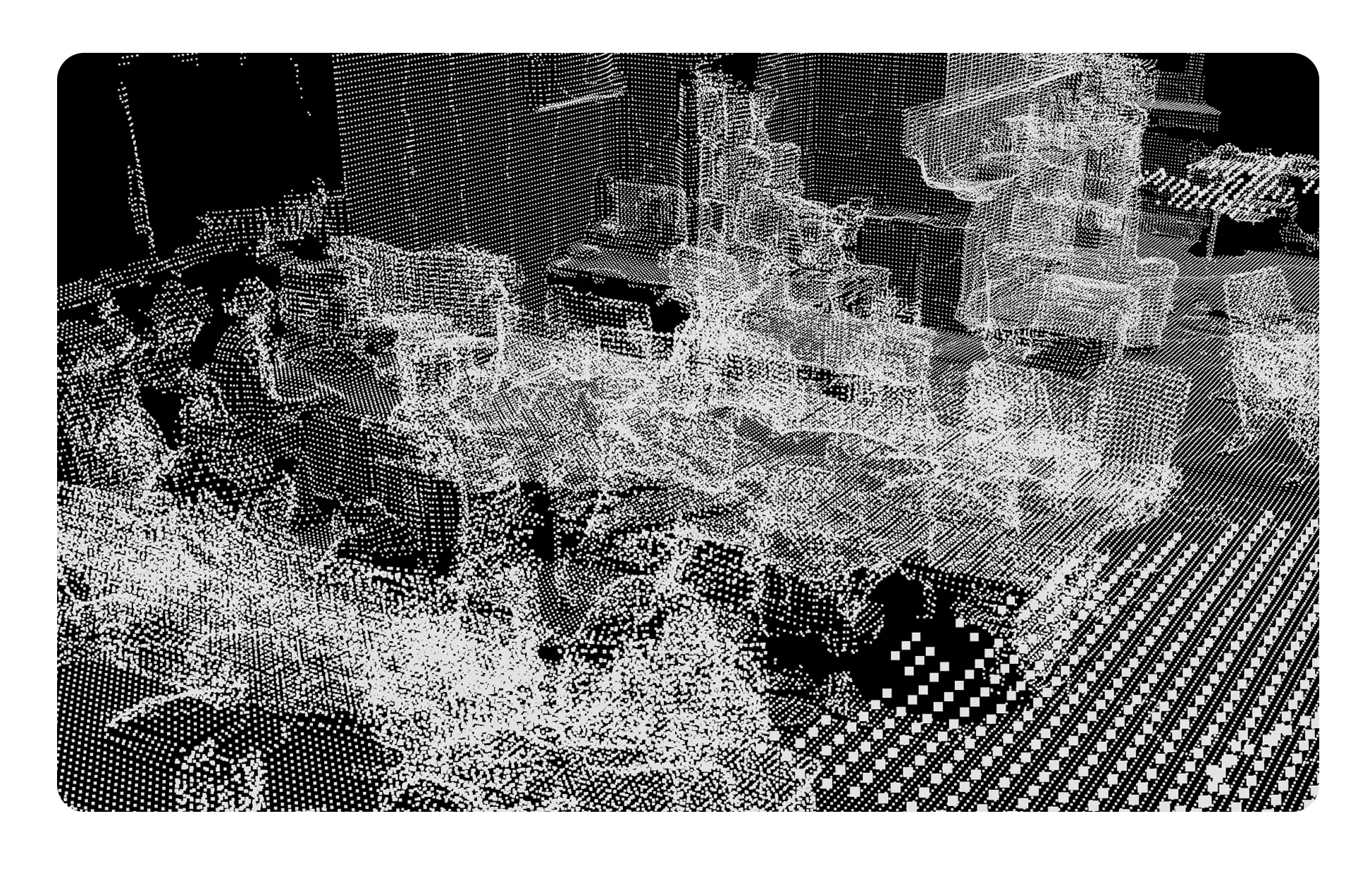
Annotate RGB, thermal, multispectral, and LiDAR data without switching tools. Maintain label consistency across sensor types for the same scene - critical for models that fuse multiple inputs at inference.
Multi-spectral annotation in one platform
Annotate RGB, thermal, multispectral, and LiDAR data without switching tools. Maintain label consistency across sensor types for the same scene - critical for models that fuse multiple inputs at inference.
Geospatial and aerial-native tooling
Purpose-built support for geospatial formats, orthomosaics, and large-area scene annotation. Designed for aerial data - not adapted from ground-level CV tools.
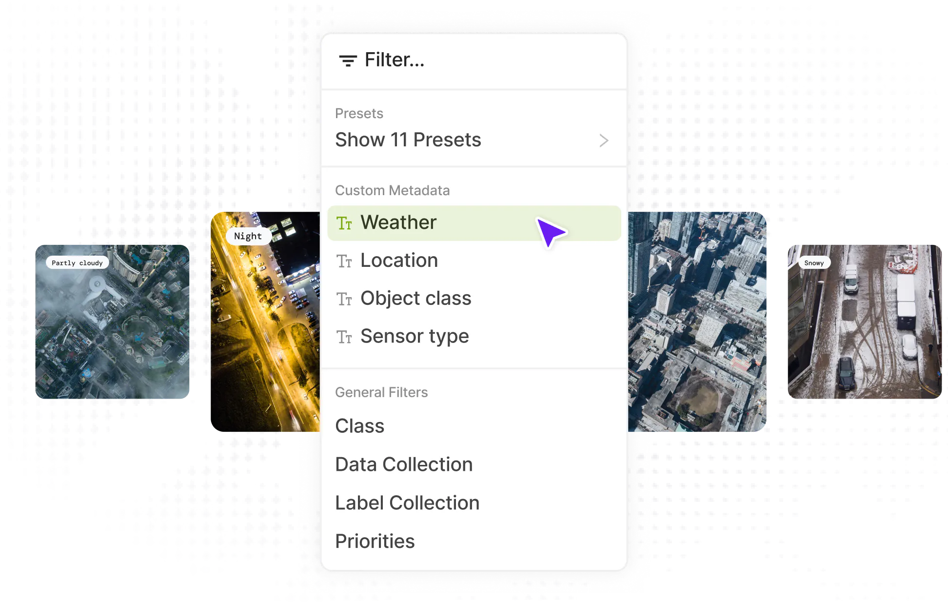
Condition-stratified curation
Identify gaps in training data coverage by altitude, weather condition, terrain type, or time of day. Systematic curation reduces production failures in novel environments before they surface in deployment.

Managed annotation services
Encord provides expert annotators with aerial and inspection domain experience - covering defect detection, infrastructure inspection, object tracking, and change detection workflows. Same platform quality controls, no separate vendor.
Data collection for aerial programs
Need structured aerial data collection - thermal surveys, LiDAR captures, multispectral runs? Encord's data services team supports end-to-end collection programs, from sensor capture to labeled dataset delivery.
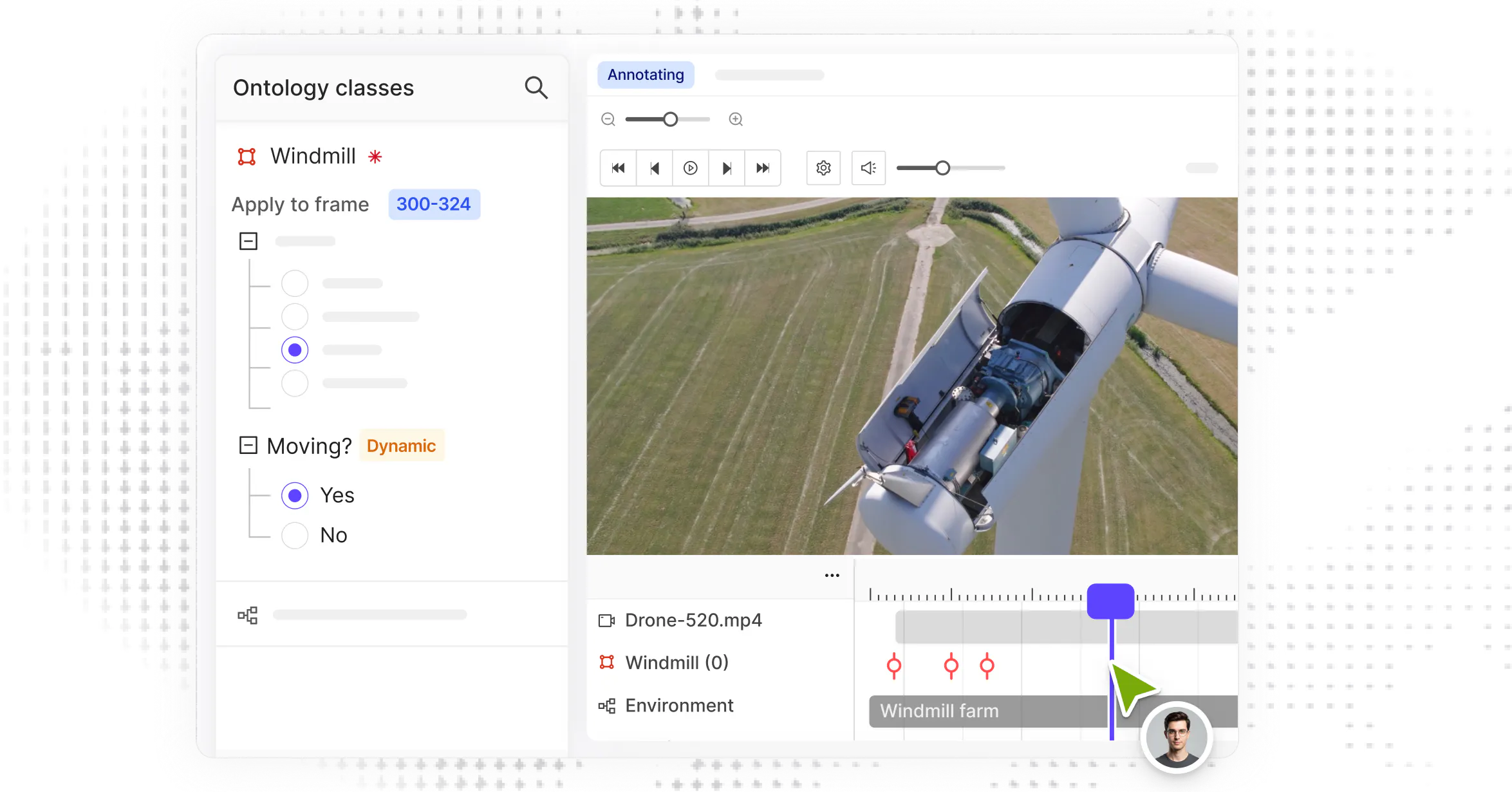
Inspection and monitoring workflow
Structured annotation for defect detection, asset monitoring, and anomaly marking - with quality controls built for the precision infrastructure inspection and public safety require.
Inspection and monitoring workflow
Structured annotation for defect detection, asset monitoring, and anomaly marking - with quality controls built for the precision infrastructure inspection and public safety require.
Supported Data Types
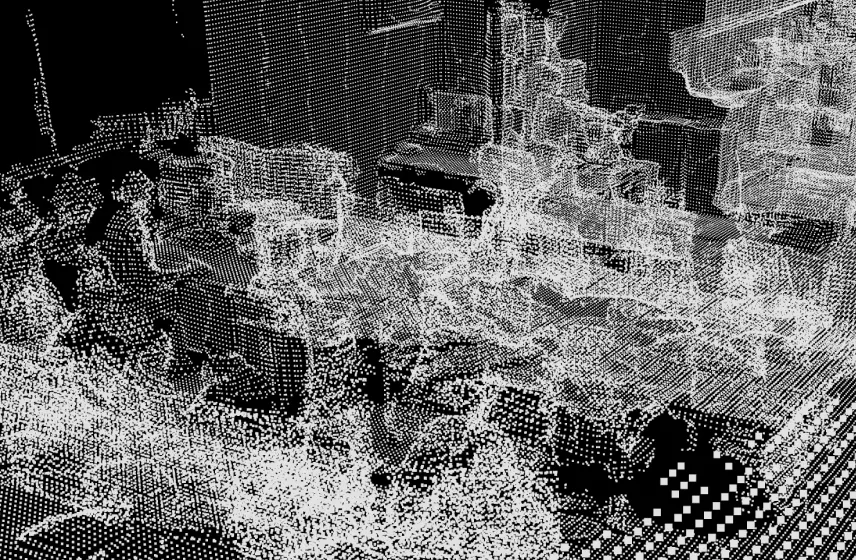
LiDAR

RGB image & video
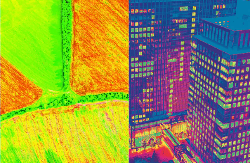
Multispectral & thermal

Geospatial
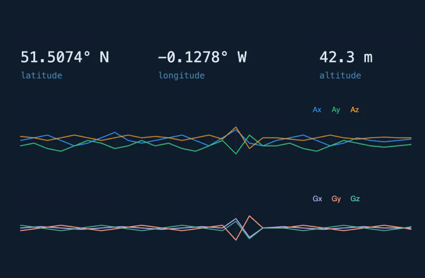
GPS/IMU
Enterprise-grade.
Built for scale.
Designed for reliable AI.
Built for scale.
Designed for reliable AI.
API/SDK-first. Zero data migration. Your data stays in your cloud.
Visit trust centre


Get the data right
300+ of the best AI teams in the world use Encord. Join them.