Full Guide to Building an Autonomous Vehicle Training Dataset

TL;DR: Autonomous vehicles are only as good as the data they learn from. This guide walks through what an AV training dataset actually contains (camera, LiDAR, radar, and more), the annotation types that turn raw sensor streams into usable ground truth, the biggest challenges teams hit when collecting and managing this data at scale, and where to source it, from open datasets like nuScenes and Waymo Open Dataset to managed data services like Encord that handle curation, annotation, and collection for you.
Progress in autonomous vehicles has always been described as a race between companies, chips, and models. In practice, it's a race for data.
A 2016 RAND Corporation analysis found that autonomous vehicles would need to log hundreds of millions of miles, and in some safety scenarios, hundreds of billions of miles, before their reliability could be demonstrated with statistical confidence, and that existing test fleets would take tens to hundreds of years to log that much driving on public roads alone (Rand, 2016). That finding is a big part of why the industry shifted so strongly toward simulation, scenario mining, and dense, high-quality training datasets rather than relying on raw mileage.
A decade later, that data-first bet looks like it's paying off. Waymo's own safety data hub, built on NHTSA Standing General Order crash reporting, now covers over 220 million fully autonomous miles through the first quarter of 2026, and reports 94% fewer crashes causing serious or fatal injury compared with human drivers over the same routes (Waymo, 2026). An independent 2026 IIHS study using the same NHTSA crash-reporting data found Waymo's overall crash involvement rate was 68% lower than human drivers across four U.S. cities, with 85% fewer single-vehicle crashes and 81% fewer injury crashes per mile driven (Carrier Management, 2026). None of that is possible without a training and validation data pipeline built for scale, diversity, and precision, which is exactly what we cover in this guide.
The commercial pressure behind a strong data pipeline is intense. Market estimates vary widely depending on scope, but Precedence Research puts the global autonomous vehicle market at roughly $273.75 billion in 2025, growing to about $364.08 billion in 2026 and projected to reach $5.44 trillion by 2035 at a 34.84% CAGR (Precedence Research, 2026). At CES 2026, NVIDIA underscored where that growth is heading by releasing Alpamayo, an open family of vision-language-action models, simulation tools, and datasets built specifically for reasoning-based autonomous driving systems (Interesting Engineering, 2026). Whatever the exact market number, one thing every serious autonomous vehicle team agrees on: the model architecture matters less than the dataset it's trained on.
What Is a Training Dataset for Autonomous Vehicles?
A training dataset for autonomous vehicles is a structured collection of sensor recordings, usually camera, LiDAR, radar, GPS/IMU, and sometimes audio, paired with human- or AI-verified labels that tell a model what it's looking at. Raw sensor output has no inherent meaning to a neural network; it's the annotation layer that turns a stream of pixels or point cloud coordinates into semantic concepts like "pedestrian," "stop sign," or "drivable lane".
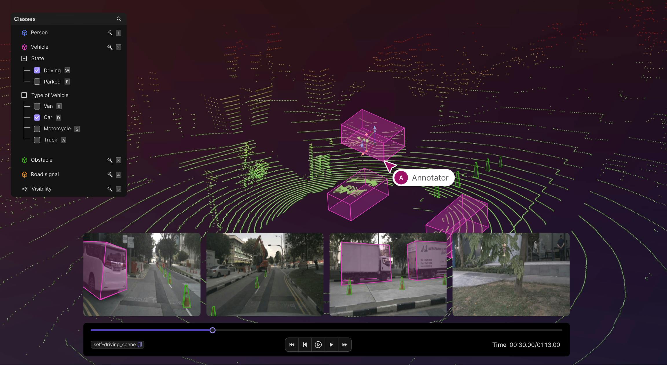
| Annotation type | What it captures | Primary sensor | Typical use case |
| 2D Bounding Boxes | Rectangular boxes around objects in an image | Camera | Object detection (vehicles, pedestrians, signs) |
| Lane Marking / Polyline Annotation | Lines drawn along lanes, road edges, and sidewalks | Camera | Lane-keeping, lane-departure warnings |
| Semantic Segmentation | Pixel-level classification of the full scene | Camera | Drivable-area detection, road-surface understanding |
| Video Tracking Annotation | Object identity maintained across frames | Camera / multi-camera | Pedestrian and vehicle trajectory prediction |
| Point Annotation | Single-point labels (e.g., keypoints, landmarks) | Camera / LiDAR | Pose estimation, sparse landmark tracking |
| 3D Object Recognition (Cuboids) | 3D bounding boxes around objects in point clouds | LiDAR | Obstacle detection, distance estimation |
| 3D Segmentation | Point-level classification of a 3D scene | LiDAR | Fine-grained scene understanding, occupancy mapping |
Why Is High-Quality Training Data Critical for Autonomous Vehicles?
Autonomous vehicles' perception systems are more data-dependent than almost any other AI application in production today. The quality of an autonomous vehicle system depends largely on the type, volume, and diversity of the training data used to build it, because a vehicle has to recognise and safely respond to every scenario it might encounter, most of which it will only ever see once.
The Cost of Poor Data
Weak or narrow training data doesn't just produce a slightly less accurate model; it produces blind spots that only surface in the real world, often in the exact edge cases the vehicle was never trained on: unusual lighting, occluded pedestrians, or a driver who signals late. Insufficient annotation accuracy compounds this: self-driving cars are becoming more reliable, but still need to move from roughly 95% accuracy toward 99%, which requires the vehicle to better perceive the road and understand the unusual patterns of human behaviour, something that only comes from cleaner, more complete ground truth.
Volume, Diversity, and Accuracy: The Three Pillars
- Volume: enough examples of each scenario type for a model to generalize, not memorize.
- Diversity: geographic, weather, lighting, and vehicle/pedestrian-behavior variation. A sound data strategy has to identify when a dataset is sufficient and when real-world experience is still required, particularly for deviant scenarios like a car turning without signaling or a pedestrian jaywalking.
- Annotation accuracy: every bounding box, cuboid, or segmentation mask has to be right, because errors compound through training and are far harder to catch after deployment than before it.
What Data Types Are Captured in an AV Training Dataset?
Modern autonomous vehicles are outfitted with 15–20+ external sensors continuously capturing data to perceive the environment, and a single Waymo vehicle records roughly 1.2 GB of sensor data every second. Here's what that sensor stack typically includes:
| Sensor | What it captures | Strengths | Limitations |
| Camera | 2D and 3D images/video of the surrounding scene | Rich semantic detail (signs, lane markings, colors) | Degrades in poor lighting/weather |
| LiDAR | High-resolution 3D point clouds via laser ranging | Precise depth and distance measurement, works in the dark | Expensive, weaker in fog/heavy rain |
| Radar (incl. 4D radar) | Object distance, velocity, and motion prediction | Reliable in adverse weather where cameras/LiDAR struggle | Lower spatial resolution than LiDAR |
| Audio / in-cabin sensors | Voice commands, driver eye gaze, drowsiness cues | Enables driver-monitoring and voice-interaction features | Narrower use case, mostly cabin-focused |
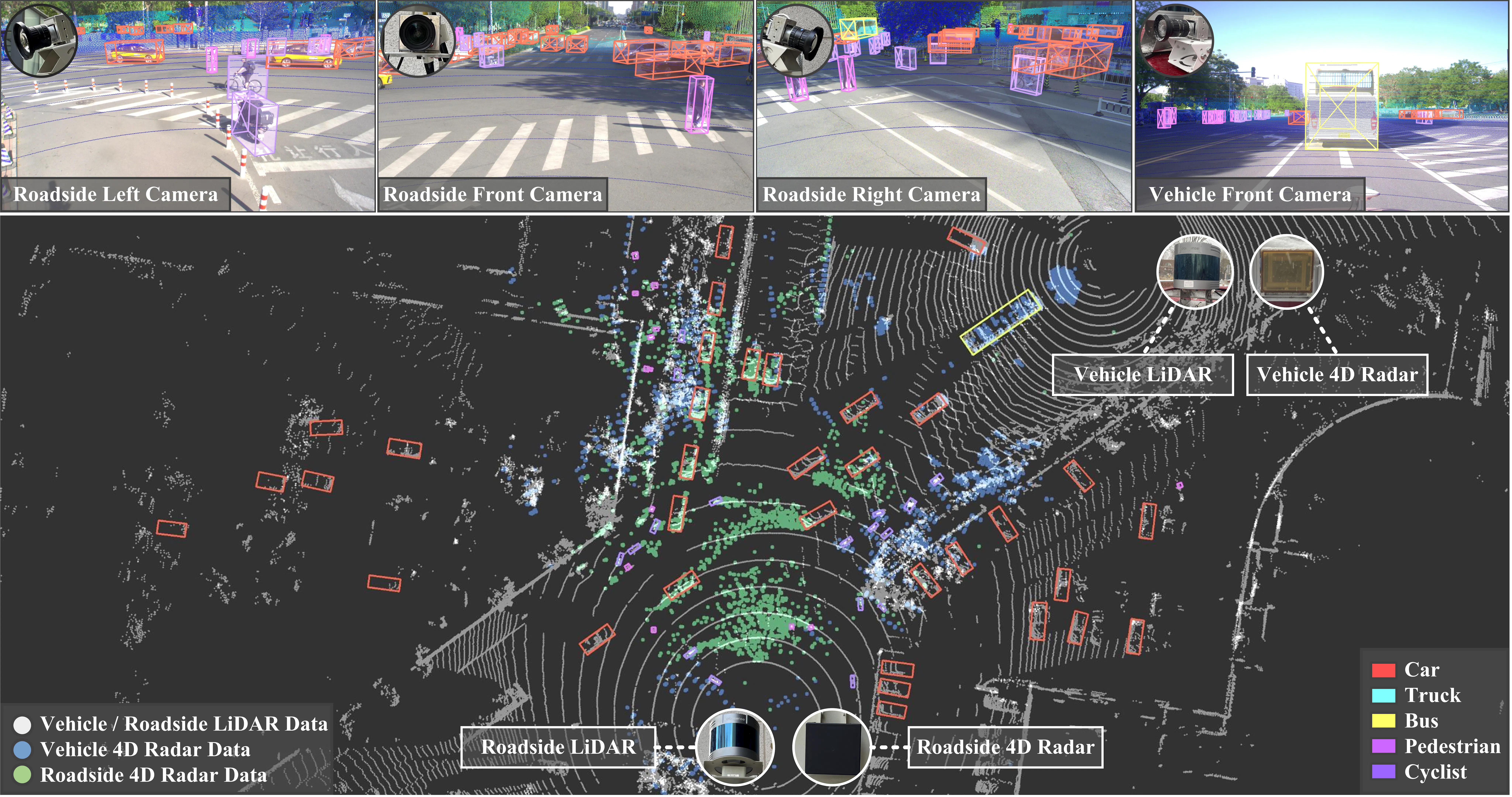
Radar's weather resilience is becoming more important as the field matures. 4D radar maintains stable perception in extreme weather conditions where cameras and LiDAR-only systems degrade, which is why researchers built V2X-Radar as the first large-scale cooperative perception dataset combining 4D radar with camera and LiDAR data.
What Annotation Types Are Used to Build AV Training Datasets?
Every one of the sensor streams above needs a different annotation approach. Camera images are typically annotated with bounding boxes, lines, polygons, or semantic masks to identify objects like vehicles, pedestrians, or traffic signs, while LiDAR point clouds are annotated to distinguish objects and their relative distance from the vehicle for tasks like obstacle detection and avoidance.
| Annotation type | What it captures | Primary sensor | Typical use case |
| 2D Bounding Boxes | Rectangular boxes around objects in an image | Camera | Object detection (vehicles, pedestrians, signs) |
| Lane Marking / Polyline Annotation | Lines drawn along lanes, road edges, and sidewalks | Camera | Lane-keeping, lane-departure warnings |
| Semantic Segmentation | Pixel-level classification of the full scene | Camera | Drivable-area detection, road-surface understanding |
| Video Tracking Annotation | Object identity maintained across frames | Camera / multi-camera | Pedestrian and vehicle trajectory prediction |
| Point Annotation | Single-point labels (e.g., keypoints, landmarks) | Camera / LiDAR | Pose estimation, sparse landmark tracking |
| 3D Object Recognition (Cuboids) | 3D bounding boxes around objects in point clouds | LiDAR | Obstacle detection, distance estimation |
| 3D Segmentation | Point-level classification of a 3D scene | LiDAR | Fine-grained scene understanding, occupancy mapping |
Why Is Data Annotation Central to Training AV Models?
From Raw Sensor Data to Structured Ground Truth
Sensor data on its own is just noise to a neural network. Neural networks have to be trained to understand semantic concepts like lanes, signs, pedestrians, and cars, which requires enormous datasets with each sensor reading manually labeled by humans to generate the structured ground truth needed for training.
Annotation is the step that provides that ground truth, and it's the single biggest reason data pipelines, not just model architecture, determine how fast an AV program can iterate.
Real-World Use Cases Powered by Annotated Data
- Object detection & tracking: Annotation techniques identify pedestrians, cars, road signals, and more within an image, helping the vehicle detect and track objects with greater accuracy.
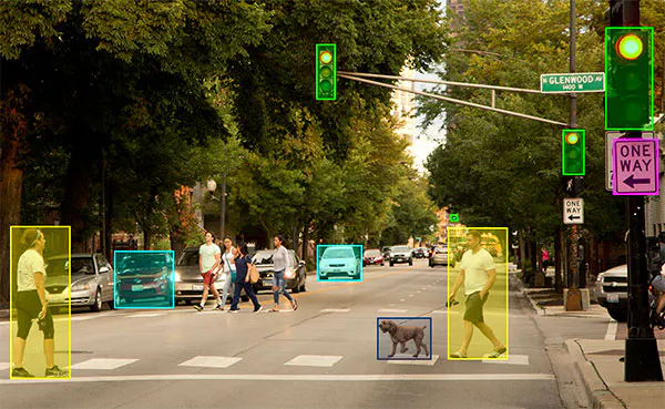

- Number plate detection: Bounding box annotation is used to locate and extract number plates from vehicle images
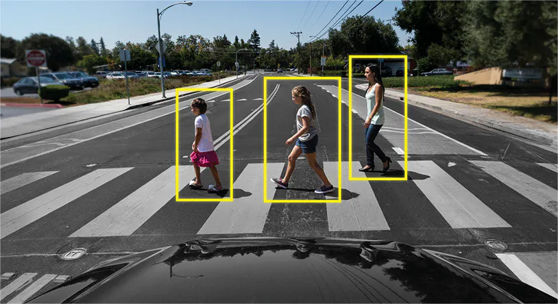
- Pedestrian tracking: Pedestrian movement is tracked and annotated frame by frame so the vehicle can accurately pinpoint pedestrian trajectories.
- Lane differentiation: Polyline annotation draws lines over lanes, streets, and sidewalks to enable accurate lane differentiation.
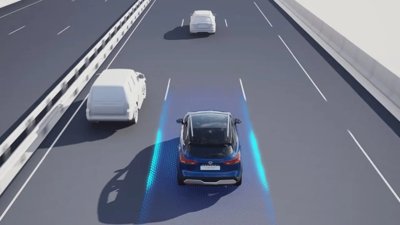
- ADAS systems: Bounding boxes for pedestrians, cyclists, and hazards train the perception layer behind lane-departure warnings, collision alerts, and blind-spot detection.
- Driver monitoring / in-cabin systems: Annotated images of alert and drowsy drivers' faces train models to detect fatigue and trigger alerts when a driver's focus wavers
- Accident prediction: Models trained on annotated sensor data track nearby vehicles and pedestrians to predict potential collisions and trigger preventive manoeuvres.
- Driver identity verification: Annotated facial-recognition data supports identity verification for shared and autonomous ride-hailing fleets.
What Are the Core Challenges in Collecting and Managing AV Training Data?
Building an AV dataset is as much an infrastructure problem as a data problem. As a self-driving dataset grows into a multimodal automotive dataset with cameras, LiDAR, radar, and maps, every part of the pipeline becomes more complex, storage, processing, curation, training, and iteration and what works for thousands of samples quickly breaks down at millions or billions of samples.
| Challenge | Why it's hard |
| Scale and unstructured data | Multi-camera systems, different sensors, and varying frame rates create a large, unstructured jumble that has to be organized before it's usable. |
| Long-tail / edge-case scenarios | Rare events (a jaywalking pedestrian, an overturned truck) occur too infrequently in naturalistic driving for passive collection to reliably capture them. |
| Sensor synchronization | Self-driving datasets often involve grouped samples combining frames from multiple cameras and LiDAR scans taken at the same timestamp, and misclassifications or gaps between sensors create real problems for model training. |
| Weather, lighting, and geographic diversity gaps | Accident risk in rainy conditions is roughly 70% higher than in normal weather, yet most historical benchmark datasets under-represent adverse weather and low-light conditions. |
What Advanced Techniques Improve AV Dataset Quality?
Once data is collected, the highest-leverage work often isn't collecting more, it's finding what's missing.
Data Curation with Embeddings
Embeddings help identify how similar or dissimilar samples in a dataset are to one another, creating a map that highlights clusters of similar samples and pinpoints gaps, for example, distinguishing a cluster of nighttime scenes from a cluster of typical daytime driving. This matters because annotating everything in a large-scale AV dataset simply isn't feasible or affordable, the goal is to find the data points a model hasn't seen before and label those.
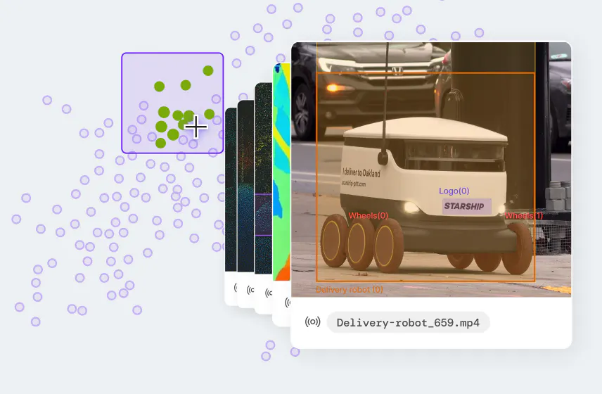
Multimodal Data Embeddings with Encord
Auto-Labeling with Pretrained/Foundation Models
Zero-shot pretrained models can recognize common real-world objects like pedestrians, traffic signs, and cars without needing human annotation for every sample, and tools like SAM3 can instantly segment cars, roads, and the sky within a scene. Depth-estimation models add another layer, helping teams understand how far away objects are without manual measurement.
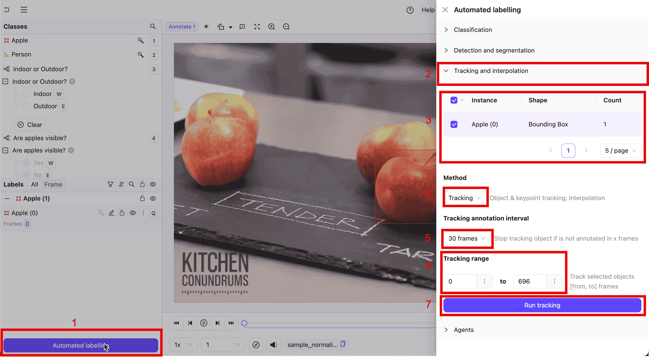
Automated Labeling with Encord Platform
Active Learning & Similarity Search
Once embeddings surface a gap or edge case, similarity search lets a team pull every visually related sample from the dataset in seconds, useful for auditing an entire class of objects (all traffic signs, all night scenes) at once rather than reviewing the dataset frame by frame.
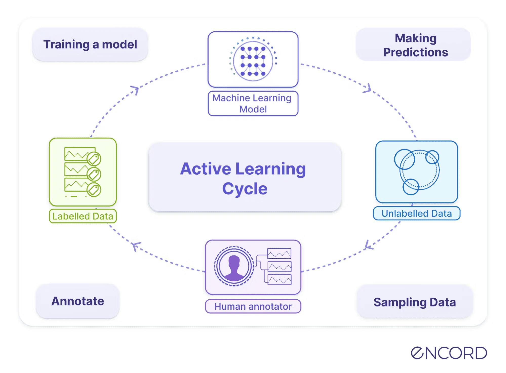
Active Learning Cycle with Encord

Simulation and Synthetic Data Generation
Tools like DriveStudio and Gaussian Splats let researchers build 3D environments that simulate real-world driving conditions without being on the road, opening new possibilities for testing and validating models in a fraction of the time. This is increasingly where the field is heading: NVIDIA's Alpamayo release specifically pairs open models with simulation tools and real-world datasets for reasoning-based driving systems.
Synthetic Data
How Do You Obtain the Right Training Dataset for Autonomous Driving?
Open-Source Autonomous Driving Datasets
Foundational datasets most AV teams still benchmark against:
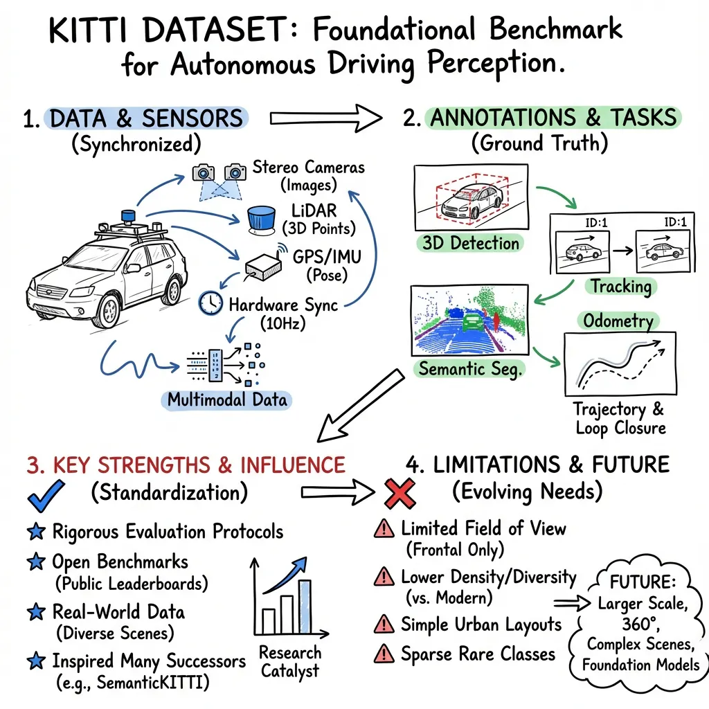
- KITTI: Released in 2012 and captured with stereo cameras, LiDAR, and GPS/IMU, KITTI remains one of the most widely cited benchmarks in the field, with 15,000+ annotated frames. It's best suited for object detection, tracking, and comparing new models against a long-standing benchmark. [IMAGE]
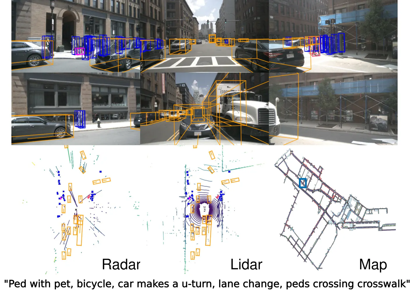
- nuScenes: Released in 2019, nuScenes pairs camera, LiDAR, radar, IMU, and GPS data across 1,000 driving scenes captured in Boston and Singapore. It's the go-to choice for 3D object detection and tracking work, since it was one of the first large-scale datasets to fuse all three core sensor types.

- Waymo Open Dataset: Also released in 2019, this dataset combines LiDAR and camera data across a wide range of environments, weather conditions, and driving scenarios. Its real-world scale makes it a strong choice for perception benchmarking at production-level diversity
- Cityscapes: Built from camera data across 50 cities, Cityscapes offers 5,000 finely annotated images and remains the standard reference point for semantic segmentation work.
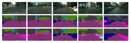
- BDD100K: Released in 2020, BDD100K brings over 100,000 diverse camera-only driving images to the table, making it a strong pretraining dataset for perception models before fine-tuning on more specialized data.
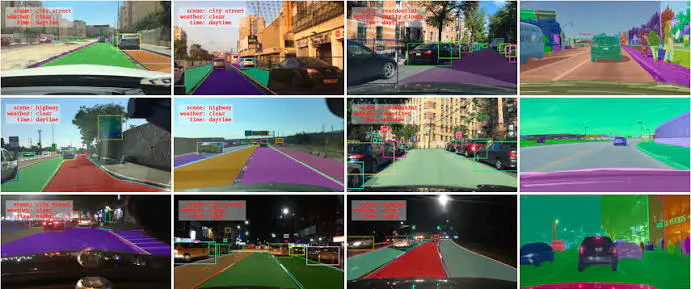
2024–2026 additions worth knowing about, most addressing gaps the foundational datasets left open, commercial vehicles, new sensors, adverse weather, and reasoning:
- MAN TruckScenes: The first large-scale multi-modal dataset designed specifically for autonomous trucks, addressing trailer occlusion and logistics-terminal environments that passenger-car datasets don't cover
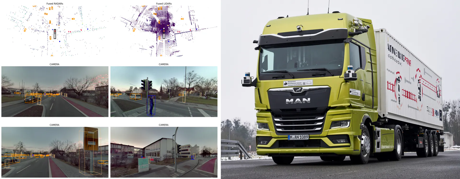
- Adver-City: Built in CARLA, this dataset recreates the most dangerous road configurations across six weather conditions, including the first simulation of blinding strong-light glare.
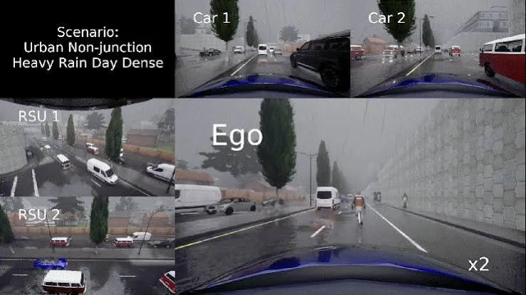
- V2X-Radar: The world's first large-scale vehicle-to-infrastructure cooperative perception dataset containing 4D radar, filling a gap for all-weather autonomous driving research.
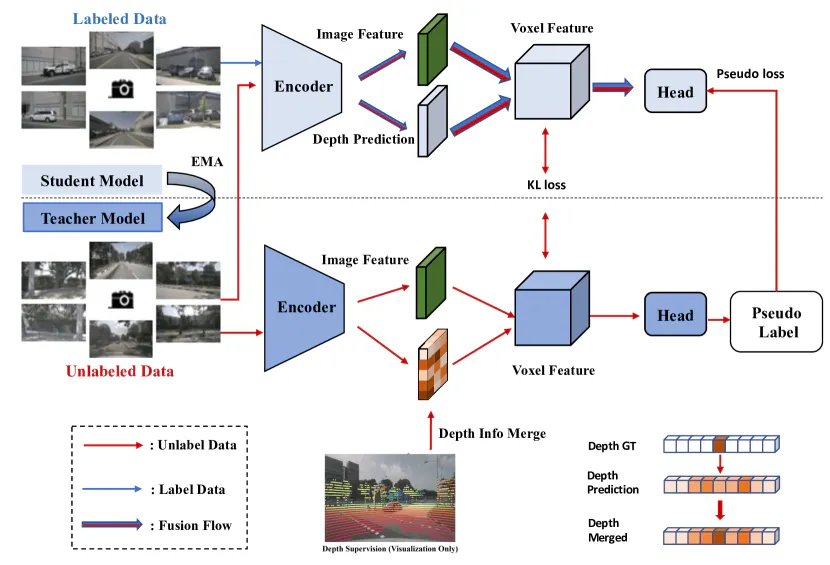
- UniOcc: Merges real-world data from nuScenes and Waymo with simulated CARLA and OpenCOOD environments to unify occupancy perception and forecasting in a single benchmark.
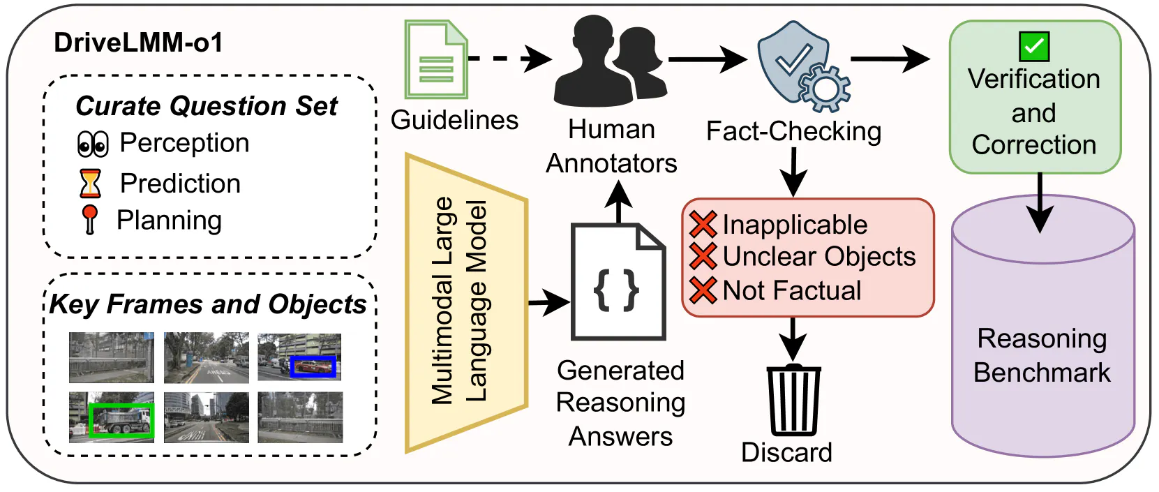
- DriveLMM-o1: The first dataset built specifically for step-by-step reasoning in autonomous driving, covering perception, prediction, and planning with full reasoning-chain annotations.
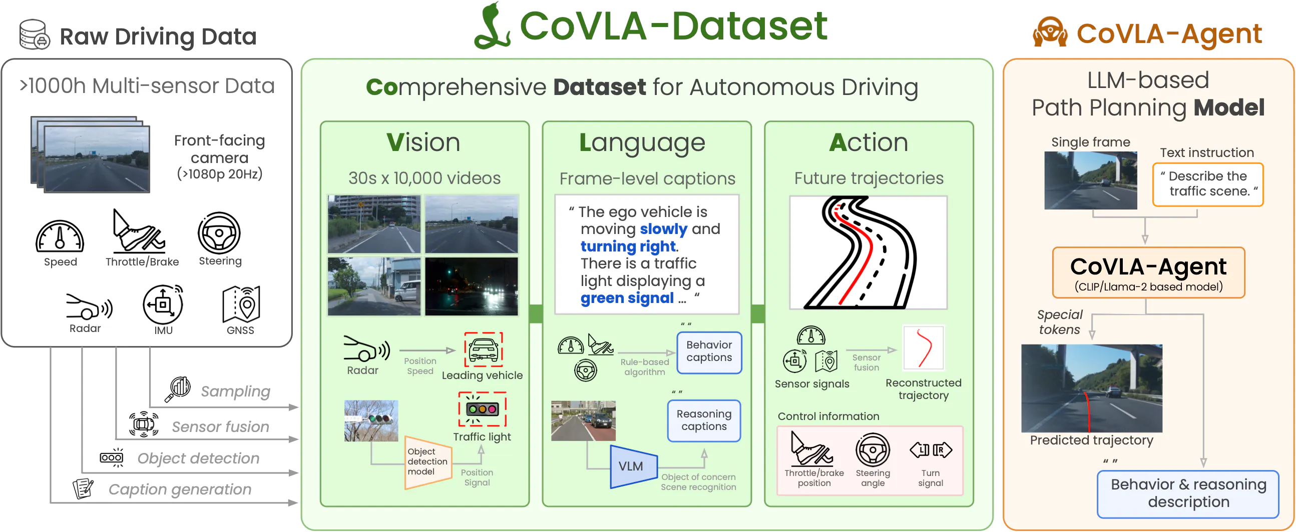
- CoVLA:The first large-scale Vision-Language-Action dataset for autonomous driving, built on over 1,000 hours of Tokyo driving data with natural-language scene descriptions and trajectory annotations.
- NVIDIA Alpamayo datasets: Released at CES 2026 alongside Alpamayo 1, an open vision-language-action model that lets vehicles understand their surroundings and explain their actions.
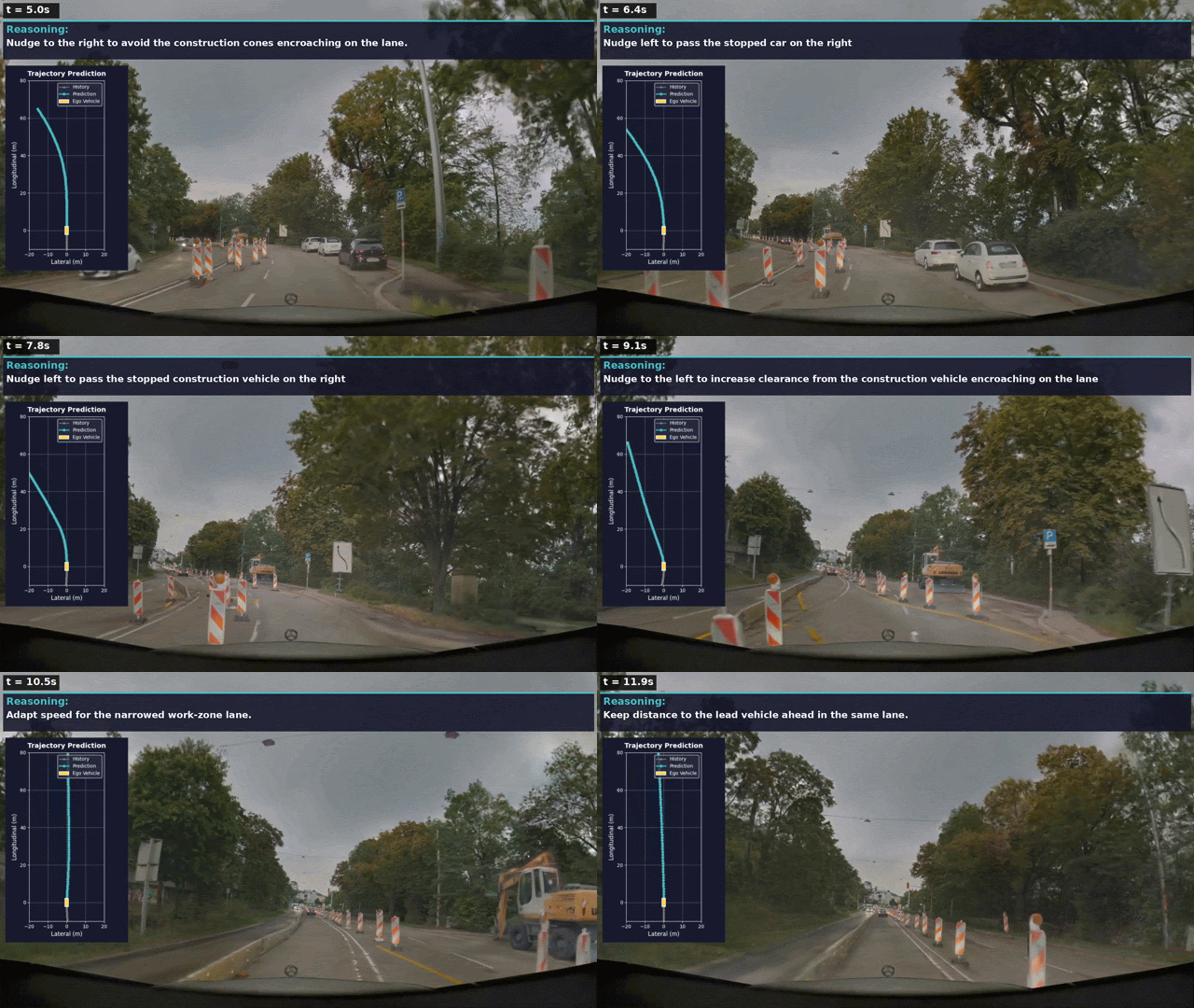
One Key limitation: Open datasets are an excellent starting point, but they might not cover all the scenarios encountered in specific commercial applications, so complementing them with your own data and annotations is often necessary to fully meet operational needs.
This is exactly the gap most AV and ADAS teams run into once they move from research benchmarking to production deployment.
Encord for Autonomous Driving Training Datasets
When public datasets stop covering your operational design domain, the work shifts to building and maintaining your own pipeline, and this is where most AV teams underestimate the engineering lift required.
- Data curation: surfacing high-signal edge cases across massive, multi-format datasets so teams aren't paying to annotate redundant frames. Encord makes it easy to surface high-signal edge cases and refine annotations across 3D, video, and sensor data within complex driving scenes.
- Data annotation & labeling (2D/3D, sensor fusion): Encord's 3D Scene binds multiple timestamped sensor streams, point clouds, images, and camera-parameter streams, into one time-synchronized unit, supporting full camera intrinsics and extrinsics across pinhole, radial, Brown-Conrady, fisheye, and OpenCV rational-polynomial distortion models, which is what makes it possible to propagate labels consistently across sensors.
- ADAS-specific pipelines: ADAS annotation is harder than standard computer vision labeling because labels have to stay consistent across cameras, LiDAR, and radar, and across time, sensor fusion is where most AV and ADAS datasets spend their annotation budget.
- Data collection / data services: managed collection and annotation of multimodal sensor data for teams that need an outsourced pipeline rather than an in-house one.
Why teams choose Encord:
- Scalability: Handling multi-hour, multi-sensor trips across large fleets, not just single-frame datasets.
- Expertise: Purpose-built tooling for AV and ADAS sensor fusion rather than generic image labeling repurposed for 3D.
- Customizable workflows: Configurable pipelines by label scheme, sensor type, and model training requirement.
- Quality control: Structured QA loops that keep annotation consistent as vehicle platforms and sensor configurations evolve over time.
- Data security & compliance: Enterprise-grade hosting options (SaaS, VPC, or on-prem) for safety-critical and regulated AV programs.
Key Takeaways
Autonomous vehicles don't fail because of bad models nearly as often as they fail because of bad, incomplete, or poorly annotated data. The teams pulling ahead, Waymo's 220-million-mile safety record, NVIDIA's Alpamayo release, and the wave of specialized 2024–2026 datasets covering trucks, adverse weather, and reasoning, all share the same underlying discipline: they treat data curation and annotation as core infrastructure, not an afterthought.
If you're building or scaling an AV training pipeline, the open-source datasets covered above are a strong foundation. But once you're validating against your own operational design domain, edge cases, and sensor stack, that's where a purpose-built platform like Encord earns its place in the stack.
Explore More Resources
- Complete Guide to LiDAR and Point Cloud Annotation for Autonomous Systems
- ADAS Data Annotation: Pipelines, Tooling and QA
- Advanced Driver Assistance Systems (ADAS): Types, Levels & Examples
- Multimodal Data Labeling: One Pipeline for Image, Video, Audio, Text & 3D
- Data Labeling for Robotics: The Complete Guide
- Best LiDAR Annotation Platforms (2026): Fast, Accurate, Sensor-Fusion Ready
- Top Data Labeling Platforms for Physical AI in 2026
- Encord Launches Support for 3D LiDAR and Point Cloud for Physical AI Development